

A tool for regional planning and development
Urbansimul automates the collection and cross-referencing of land registry data, making it easier to view and facilitating analysis as part of your planning and development strategy. It saves you a lot of time collecting and pooling data, so that you can focus your efforts on the analysis and planning phases.
This means that everyone – from small towns with limited resources to major cities with vast amounts of data to compile – have access to a comprehensive decision-making tool.
On a regional level, Urbansimul lets you:
-
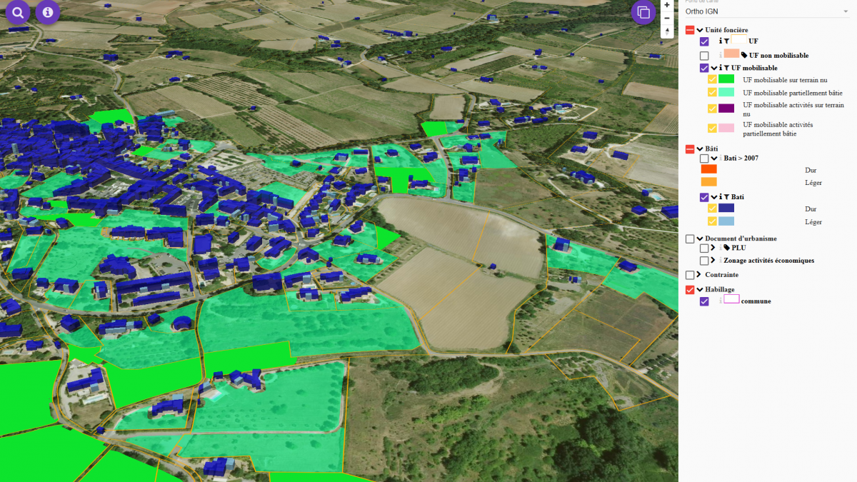
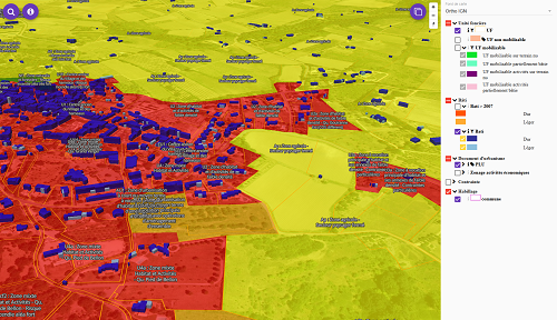
View areas with development potential on a property level, as well as any constraints on development; view zoning regulations and ownership, and download any associated GIS data.
-
Access local diagnostics featuring various indicators in terms of zoning and the municipality as a whole, with comparisons to other regions for reference.
-
Test experimental data via a data submission module: Urban development plans, species protection policies, applying risk prevention plans…
Urbansimul offers a number of advantages: its granularity on the property level sets it apart from existing tools; its database goes back to 2007, so that you can compare the feasibility of development plans against what has actually been done over the past 10+ years; and it’s a dynamic tool that lets users add and amend data (this feature can also be used to test different development plans).
A Research & Development Project
Cerema [1] teamed up with INRA [2] to develop this software in 2011. A prototype was created in 2014, before a research and development agreement was signed in 2015 to develop Urbansimul in partnership with the French Ministry of Housing, the Provence Alpes Côte d’Azur (PACA) regional council, the PACA public land registry, and the Regional Centre for Geographical Information.
It autumn 2017, it was made available free of charge to all local authorities in the region, along with decentralised government department and development agencies in the PACA region.
In 2018, the programme was ready to be adapted to other regions.
Research is an important part of the project, because a number of features are being developed and tested, and statistical analysis of the probability modules is carried out and then analysed.
Through its close regional ties, Cerema also boasts a solid understanding of the region’s needs and stakeholders, forging links with local authorities and tracking experiments conducted in the field. This position enables Cerema to propose solutions so that the tool can evolve and adapt to meet concrete needs.
Sample Urbansimul Uses
Urbansimul is used to find available property for the development of housing, industrial facilities, and businesses, as well as to conduct research upstream of regional development plans. For example, it has been used by:
-
Pays d’Apt Lubéron Community and the Rhône Avignon Vaucluse Urban Development Agency (a SCoT service provider) to analyse densification and conveyance capacity in preparation of a property strategy study and a local housing programme
-
By DREAL and a number of departmental development agencies, as part of a policy to make use of public land to build more homes and make up the shortfall in the construction of social housing
-
By the Public Land Development Agency, to analyse the land available in towns that have signed a contract with the public operator
-
By the Nice Côte d’Azur Chamber of Chamber of Commerce and Industry and PACA Regional Council, to compile and develop an observatory for economic activity areas
-
By the SNCF rail network, PACA Regional Council, and DREAL, to compile a land observatory to track the new PACA line
-
By PACA Regional Council to analyse the property development potential that could benefit from a heating network drawn from nearby datacentres
-
By Cerema Mediterranean, as part of its consulting and services role: urban planning study, eco-districts, land strategy study, land and property observatory…
-
Furthermore, INRA has used Urbansimul for its research into modelling changes to soil and their agricultural and environmental impact, and on land market dynamics: SPREE (ANR 2017), VITAL (FACCE SURPLUS 2015), Lumecos/Epidec (INRA SMASH 2015), Vigie-Med (INRA ACCAF 2013)…
[1]More specifically, Cerema Méditerranée, Regional Development Department.
[2] French National Institute for Agronomic Research in Avignon, eco-development unit.