
Cerema conducts research on high water in mountainous areas, floods and coastal flooding. It has developed a series of tools and methods to support regions in anticipating and managing flood risks, and is also interested in the post-crisis period with the objective of making regions more resilient.
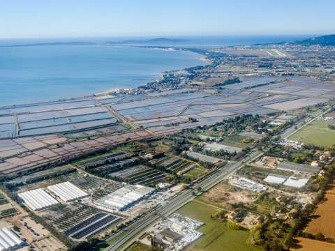
During this international day for the prevention of natural disasters on 13 October, Cerema offers a focus on flood management, which represents the most frequent natural risk on French territory, and concerns two-thirds of municipalities.
In Europe, floods are responsible for two-thirds of the damage and costs associated with natural disasters, which have been increasing since 1980 as a result of human activities and the increase in the frequency and severity of floods.
With climate change, these phenomena will increase and it is crucial to adapt land use planning to limit the impacts.
Our press kit "Cerema supports the regions in flood risk management"
Research work to better anticipate and manage flood risks
The Flood Vulnerability Framework (published in 2016) is a method that facilitates the implementation of territorial diagnostics, followed by the emergence of strategies for adapting territories and preventing risk.
Cerema supports several regions in the implementation of this framework, in particular the Region at Major Risk of Noirmoutier - Saint-Jean-de-Monts.
Among the current research work on flood risk anticipation and management:
The Inundatio project
Inundatio is an Interreg research project led by 7 Spanish, Portuguese and French partners, launched in March 2020.
Its objective: to model the risk of floods and flash floods in mountainous areas, using artificial intelligence and big data. The project should allow the development of a decision support tool for those involved in crisis management.
The Montclima project
This is a Franco-Spanish Interreg project launched in 2019.
Its objective: through 4 pilot projects, it aims to improve the coordination and effectiveness of prevention measures - in particular through nature-based solutions - and disaster management, along with the rehabilitation of disaster areas. A transnational strategy will be implemented in the context of the project.
The PICS project
Funded by the French National Research Agency, the PICS project was launched at the end of 2019.
Its objective: to better predict flash floods and their influence, in order to mitigate their impacts. The work aims to build a forecast chain thanks to the collaboration of scientific and operational stakeholders. The project will serve to improve flood forecasting models.
On 19 November, Cerema is organising a webinar dedicated to the role of citizens in the development of a risk culture at the regional level.
It will consist of several modules:
-
Going beyond preventive information with local strategies and tools
-
Attracting populations through games and new technologies,
-
Targeting the younger generations,
-
Changing perspective on risk through the arts
Modelling flood areas by assembly
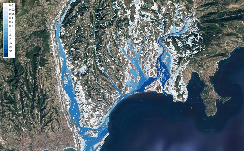
In order to map flood-prone areas in small watersheds, Cerema is developing the ExEZco method "Extraction of Flow Areas"
From the topography of the area, this method determines potentially flood-prone areas in small watersheds. Exzeco was applied to the Mediterranean arc within the framework of an interregional study relating to the management of run-off risks.
It was also used, for example, to produce the approximate envelopes of potential floods (EAIP - enveloppes approchées des inondations potentielles) used to calculate the preliminary flood risk assessment (EPRI - évaluation préliminaire des risques d’inondations) of the flood directive or to contribute post-flood feedback.
With the metropolitan community of Montreal to predict the risk of flooding
Cerema has been collaborating for the past several years with the metropolitan community of Montreal on the prevention of the risk of flooding in the regularly impacted Deux-Montagnes region.
A partnership has recently been launched in the context of flood management, to enable Cerema specialists to train the metropolitan community's referents in risk management, and bring their expertise in risk analysis by grouping numerous data and mapping flood-prone areas to produce vulnerability maps.
The risk characterisation methodology defined through this project is intended to be applicable to the entire Montreal Métropole area.
Acting after the disaster: from action on the ground to the challenges of reconstruction
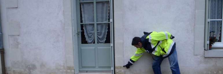
A guide to field information collection following a flood was published in 2017 by Cerema. Produced by drawing lessons from several feedbacks,
It provides a method for communities wishing to set up a protocol for collecting flood-related information during field reconnaissance operations.
The Cerema teams then developed a series of tools for conducting field surveys after floods and pooling multiple data sources.
The SCOUT, CRISI and MUREX applications, which are interconnected, allow teams in the field to easily read water heights, pool data and transmit information in a standardised way.
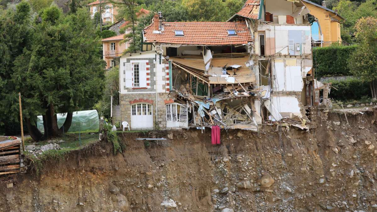
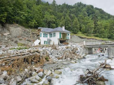
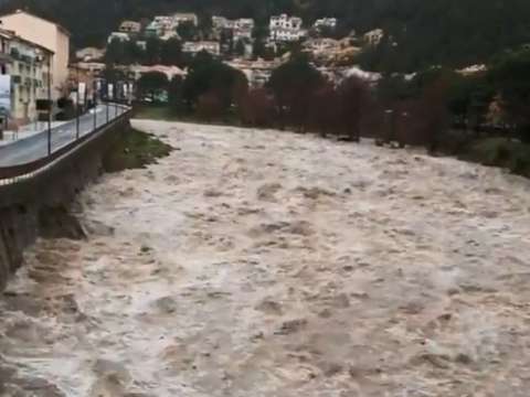
The Murex application is currently used for post-flood surveys in the Alpes-Maritimes. Reconnaissance missions were notably carried out by Cerema (photos are available at the bottom of this article).
Flooded areas can be extracted using satellite images and the CartEau application. This application was developed with the Joint association for the water management and planning scheme of SAGE de la Lys (Symsagel).
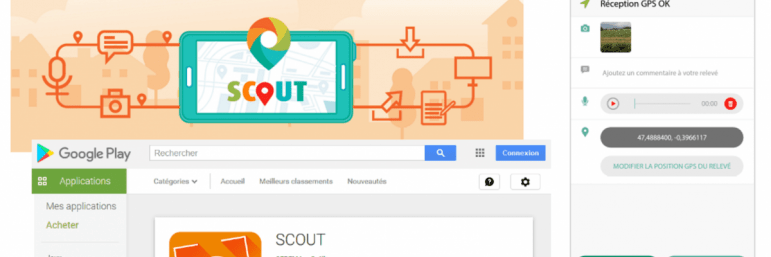
The SCOUT application
Système de COllecte Universel de Terrain (universal field collection system): an Android application that facilitates post-flood site visits (among others).
This easy to use app is used to carry out survey campaigns, integrate photos and various data, geotag this information, then format, complete and print them.
The CRISI application
Post-flood information collection and reading (Collecte et de Relevé d’Informations Suite à une Inondation): when used in conjunction with the SCOUT APPLICATION, CRISI, also available for Android, combines all the necessary tools for the exhaustive and reliable collection of flood watermark data.
After the campaign, the user connects the phone to a computer and launches the tour editor.
Feedback µtool (MUREX)
Murex is used to pool post-flood data: the tool is interfaced with CRISI and the Schapi flood marker site.
It is used to pool the information provided by various operators who have carried out field surveys, along with other data such as videos, tweets and PDF documents, and to print summary reports.
CartEau, a Qgis plug-in
The CartEau tool, co-developed by Cerema and the Symsagel joint association, is based on the use and processing of satellite imagery to identify areas affected by flooding.
The tool, available as a Qgis plugin, allows regional stakeholders to easily process satellite images in order to automatically extract areas under water.
Technical support and training from Cerema to anticipate reconstruction
The post-disaster period is essential in order to manage the return to normality and reconstruction in a way that takes into account the impact of natural disasters. It must therefore be anticipated. With this in mind, Cerema offers an approach that is part of the concept of regional resilience.
For communities and network managers, it has defined a service offering to strengthen the resilience of regions through crisis preparation and post-crisis support. This approach aims to determine the vulnerabilities of the region or organisation, prepare for crisis management, and learn from past events, capitalise on them to learn and maintain the memory of risk.
Drawing on its experience in supporting regions facing natural risks, Cerema has also set up a "Mobilising the levers of resilience" training course, aimed at communities, design offices and network managers.
This course aims to discover how the resilience approach makes it possible to go beyond crisis situations and engage the regions in a longer-term vision, integrating disruptions and relying on local strengths and potentials, as well as on the development of links and partnerships.
Post-disaster reconstruction research projects
This post-disaster period, in this case applied to Hurricane Irma that struck in September 2017 in St. Martin and St. Barthélémy, was the subject of a research project, RELEV (REconstruction of territories: LEVers for anticipating natural disasters) funded by the Agence Nationale de la Recherche. Previously, the RAITAP research project (2015-2017) examined feedback from affected regions, to identify the sustainable reconstruction processes implemented.
The Cerema-led RELEV project brought together five research laboratories to define a regional reconstruction process to allow a rapid return to normality and structural reduction of its vulnerabilities.
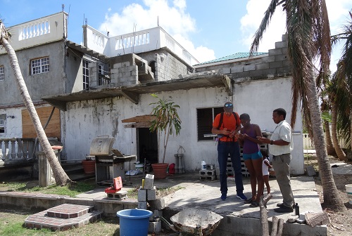
Cerema mission in Saint-Martin after hurricane Irma | J DELGADO
The planning approach developed focuses on 4 areas:
-
Recovery of institutions,
-
Recovery of populations,
-
Recovery of infrastructure and networks,
-
Historical impact of hurricanes.
A website dedicated to the project is available online